The Pululahua volcano is just a 30-minute drive from Quito, conveniently located along the Calacali-Los Bancos highway, which is the same route that leads to La Mitad del Mundo.
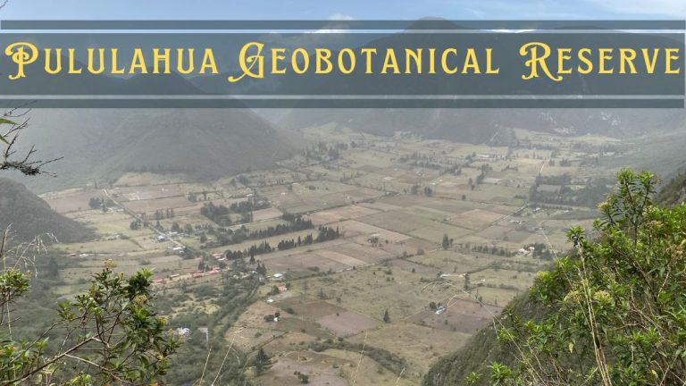
We found Pululahua Geobotanical Reserve to be a fascinating spot. It is actually Ecuador’s first designated National Park, covering an impressive 13,000 hectares. This place isn’t just about breathtaking landscapes; it serves as a natural refuge for diverse species of animals, plants, and insects. What makes it even more unique is that there’s a small community living within the crater, taking advantage of its rich agricultural land.
Pululahua is the only area in Ecuador classified as a “Geobotanical Reserve.” The biodiversity here is astounding, with over 2,000 species of Andean plants thriving in this protected zone. From exotic insects to various bird species, the reserve offers a glimpse into a rich ecosystem.
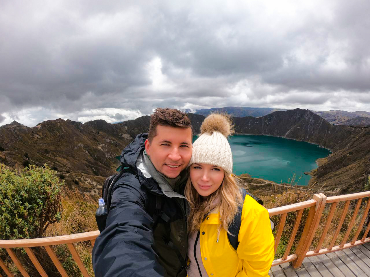
We learned that its unique geology and volcanic history are key to its existence. Apart from the lush vegetation covering the slopes and ravines, this reserve is one of the few places in the world where you can see an inhabited volcanic caldera. It truly felt like stepping into a world apart.
Looking back, visiting Pululahua required careful planning – from choosing the best time of day for clear views to figuring out transportation and preparing for the altitude. Skip the uncertainty I faced and get a FREE personalized trip quote from my trusted local experts who know exactly how to combine this hidden gem with other nearby attractions. Your booking helps support both this blog and local Ecuadorian communities.
Plan perfect trip to Ecuador & Galapagos
I spent countless hours researching everything about traveling to Ecuador, and I created this blog for fellow travel enthusiasts who want the best, most reliable information. But if you want to save time, we’ve partnered with the top local agency to plan your dream trip.
How to Get There
By Car
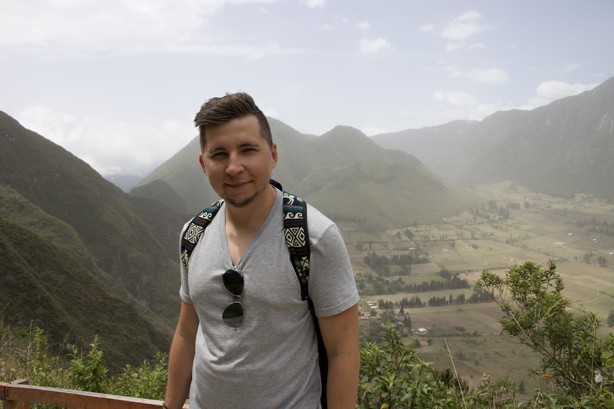
If you’re driving to Pululahua Geobotanical Reserve, it’s quite straightforward. We took the Quito-Calacalí highway, which is just 4.5 miles (about 6 kilometers) beyond the famous Mitad del Mundo monument. There’s a gas station near Caspigasi—this is where you need to turn right. From there, it’s only a 1.2-kilometer drive up to the mirador (viewpoint). The route is well-marked, and once you reach the mirador, you’re rewarded with a stunning panoramic view of the volcanic caldera below.
By Bus
Take a Metrobus from Quito to any of the stops on Avenida la Prensa and Avenida América until you reach the Ofelia station.
Change to the Mitad del Mundo (Middle of The World) – Kartódromo feeder from here. Jump off at Mitad del Mundo, where you may rent a pickup (camioneta) to drive you up to Ventanilla overlook or into the crater town.
By Taxi
If you do not have a car, taking a cab is the fastest way to get to Pululahua Geobotanical Reserve. A one-way trip may cost you around $30 from Quito.
Entrance Fee to Pululahua Geobotanical Reserve
There is no entrance fee to go inside the reserve. You only have to register at the ranger’s station.
Trekking in Pululahua Geobotanical Reserve
There are several trekking routes to choose from within Pululahua Geobotanical Reserve. We decided to take the popular trail that descends from the mirador, offering some breathtaking panoramic views along the way. The well-marked path led us into the crater, where you can also go hiking or mountain biking on the two hills, Pondoña and Chivo.
For those seeking a simpler hike, the Moraspungo entrance is just a 5-minute drive from Calacali. This leads to the El Viento route, aptly named for the strong breeze that sweeps through the area. It’s a relatively easy trail, perfect for all ages.
If you’re up for an adrenaline rush, there’s an epic biking route known as El Infiernillo. Starting from within the crater, it’s a thrilling 20 km downhill adventure that takes about 4 hours, descending into the Guayllabamba river basin. Perfect for those who love intense mountain biking!
Attractions in Pululahua Geobotanical Reserve
Pululahua Crater
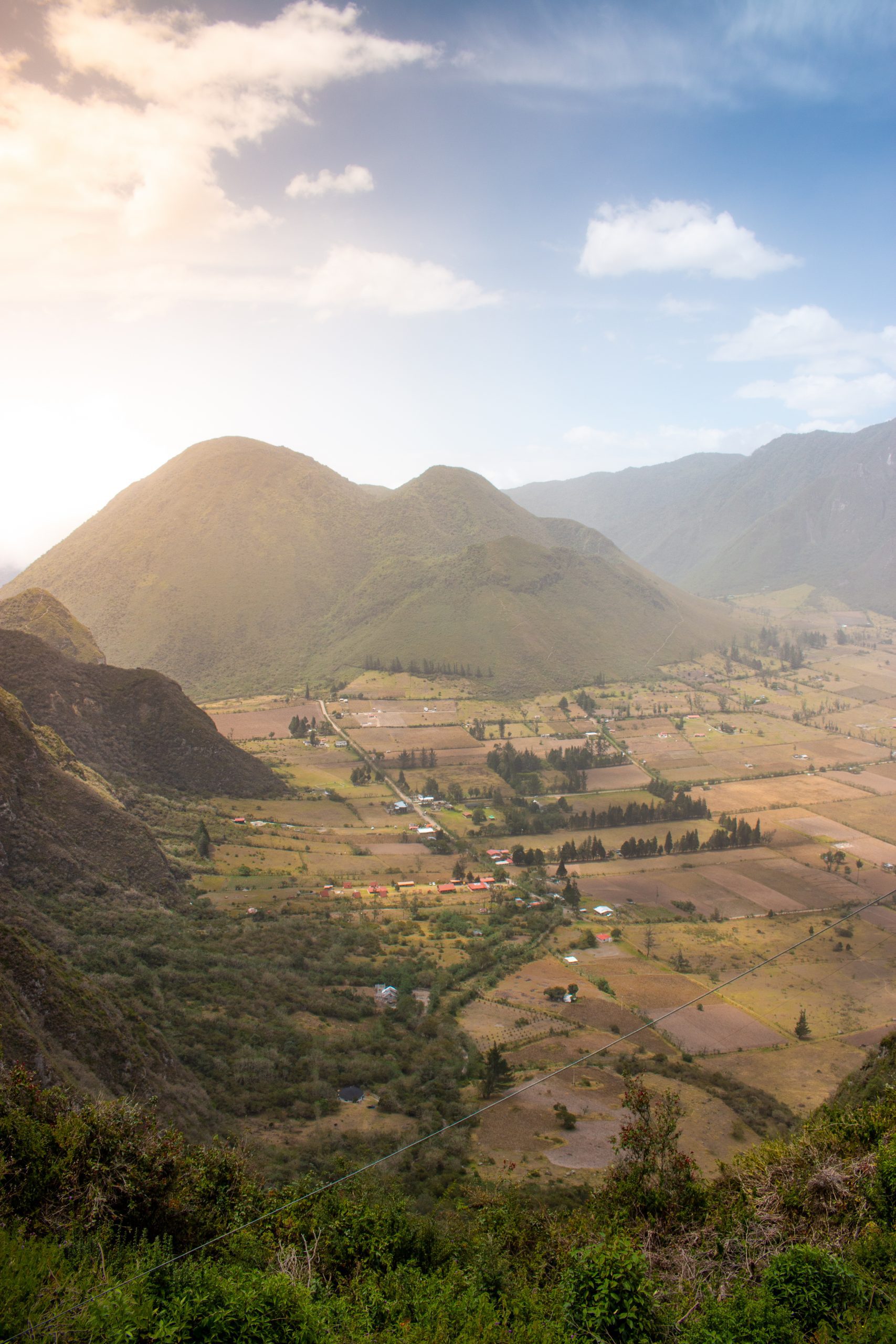
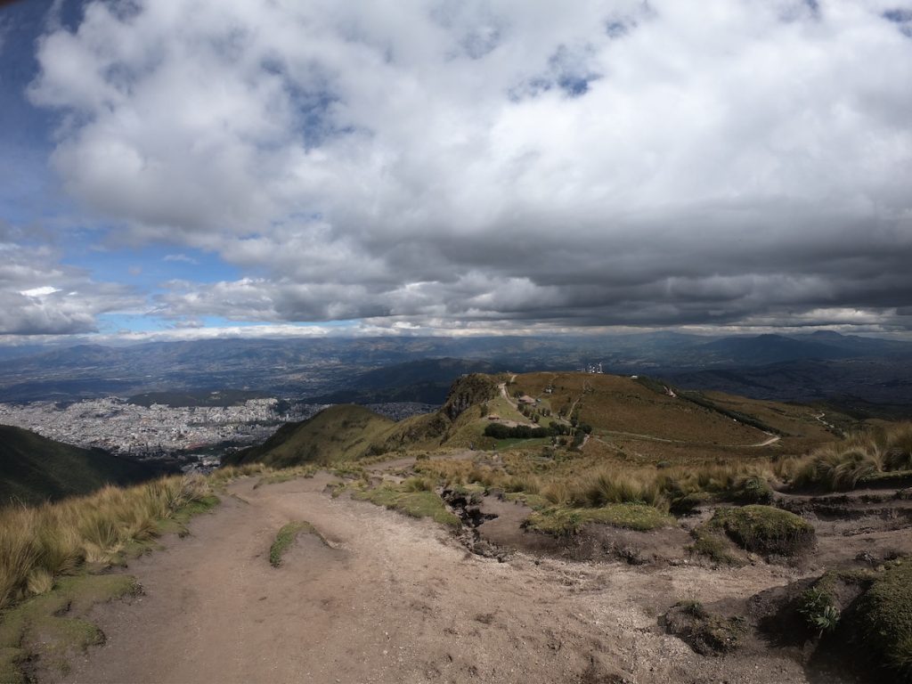
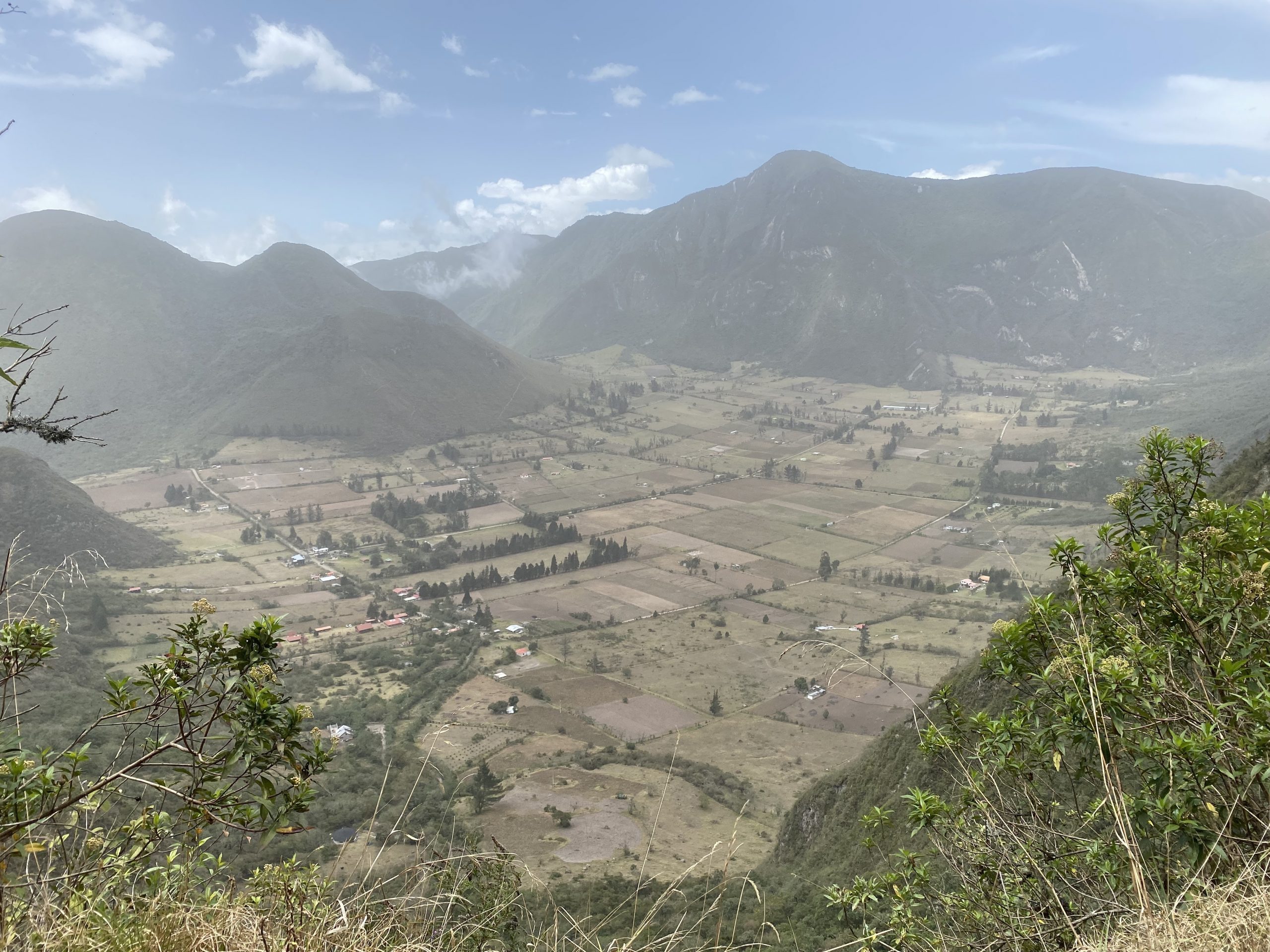
The main highlight of the Pululahua Geobotanical Reserve is its massive volcanic crater, shaped like a horseshoe. The crater opens to the north, allowing the Blanco River to flow out towards the Guayllabamba basin. This unique formation was created when the volcano’s magma drained away after its last eruption, which occurred roughly 2,450 years ago.
Surrounded by steep caldera walls, the crater offers natural protection, creating a microclimate ideal for farming. The fertile, flat lands within the caldera are perfect for cultivating a diverse range of crops. Walking through this hidden valley feels like stepping into a world cut off from the rest of Ecuador — truly a hidden gem.
El Chivo and Pondoña Peaks
El Chivo and Pondoña are two distinct volcanic dome summits within the Pululahua Geobotanical Reserve, each offering unique experiences. El Chivo, located in the northeastern part of the volcano, stands at 2,698 meters above sea level. Meanwhile, Pondoña, positioned more centrally, rises to 2,975 meters.
Both domes have well-marked hiking trails leading to their summits, where you can enjoy panoramic views of the lush caldera. If you’re up for more adventure, explore the thermal mineral water springs found in the Bucal region beneath the Pondoña dome — a hidden gem for nature enthusiasts seeking a relaxing break after a hike.
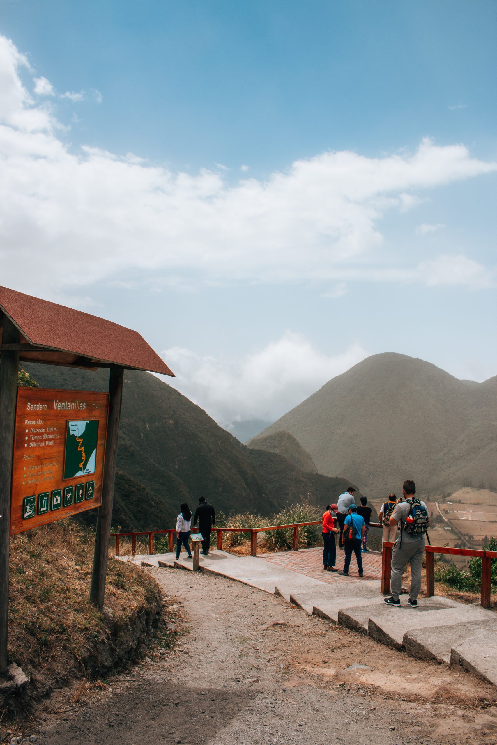
Ventanillas Lookout
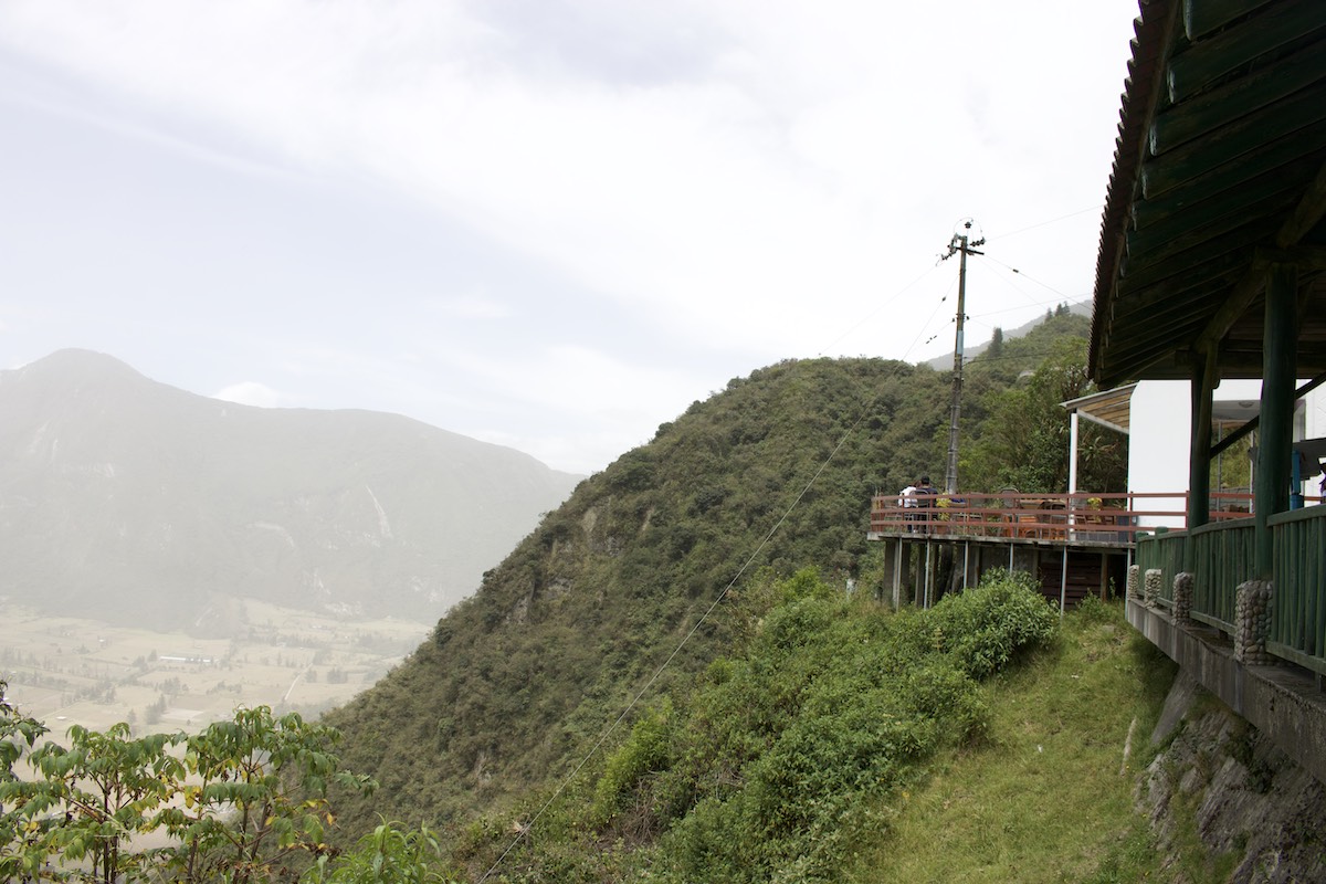
The Pululahua viewpoint, perched on the crater rim, offers stunning panoramic views of the expansive caldera and its patchwork of agricultural fields below. If you’re planning a visit, aim to arrive before midday, as the skies are usually clearest in the morning. By the afternoon, mists often roll in from the west, veiling the lower parts of the reserve and obscuring the breathtaking vistas.
Many half-day tours to the Mitad del Mundo monument include a stop at the Ventanillas viewpoint, allowing visitors to capture picturesque photos of this unique landscape. It’s a perfect addition to any equator day trip!
Pululahua Community
The Pululahua settlement, nestled within the volcanic crater, is home to around 40 families who lead peaceful lives in this distinctive environment. The ground here has a pale yellow hue, with colorful volcanic rocks adding a unique charm to the landscape.
Have questions about your upcoming Galapagos trip? Join my Galapagos Reddit community and ask other travelers who recently visited the islands. Get up-to-date tips, real experiences, and honest advice from other travelers (I ban tour agencies and resellers).
For those looking to explore the crater, the village of Pululahua serves as a perfect starting point. You’ll find eco-hostels, campgrounds, restaurants, and tour operators catering to visitors. If you’re planning a visit during a public holiday weekend, it’s wise to pre-book accommodations and services, as the area can get quite busy.
Moraspungo Recreation Area
The Moraspungo Recreation Area is perfect for a family day out in Pululahua. This spot features a wheelchair-accessible path, Sendero Adoquinado (0.8 km), which winds through the Andean forest, allowing you to explore native plants and wildlife. The trail ends at a beautiful crater viewpoint with picnic and BBQ areas, ideal for a relaxing afternoon.
For those looking to extend their stay, there are two simple cottages available for rent, or you can camp in the designated areas. It’s a great way to immerse yourself in nature while enjoying some downtime with loved ones.
Flora and Fauna

Pululahua Geobotanical Reserve is a haven of biodiversity, with a wide array of unique flora and fauna. The Ecuadorians are deeply committed to preserving this natural sanctuary.
Orchids are particularly abundant here, with about sixty species thriving in the volcanic terrain — a real treat for plant enthusiasts.
Although there hasn’t been a formal study on the fauna, the reserve is known to be home to several mammals, such as squirrels, rabbits, fruit bats, foxes, pumas, Andean bears, and weasels.
Reptiles and amphibians, including various species of lizards, boas, and toads, can also be spotted in the area. For bird watchers, Pululahua offers sightings of doves, condors, sparrows, and many more. It’s truly a diverse ecosystem waiting to be explored.
Trust me, while Pululahua is often overlooked in favor of Mitad del Mundo, it’s an incredible spot that deserves proper exploration! Want to experience this unique inhabited volcano crater while making the most of your time in northern Ecuador? Get a FREE expert itinerary from my recommended local agency. Your booking supports this blog and local Ecuadorian businesses.
When is the Best Time to Visit
Pululahua enjoys a Mediterranean-like climate, making it a great year-round destination. However, the best time to visit is between January to March and June to December when the weather is mild and there’s minimal rainfall.
The temperature in Pululahua remains quite consistent, with July being the warmest month, averaging 17°C, and March being slightly cooler at around 15°C. Whether you’re hiking or exploring the scenic views, the pleasant weather during these months makes it an ideal time for outdoor activities.
Travel Tips
Here are some tips and good-to-know details to help you prepare for your tour of Pululahua Geobotanical Reserve:
- Arrive early to increase your chances of clear skies and beautiful sights. It is also advisable to visit during the week rather than on weekends, which are more popular with local tourists.
- Be well-prepared. The weather in Pululahua is unpredictable, with the bright sun at times and wet and freezing at others.
- You’ll need decent walking shoes because the terrain is sandy, rough, and steep.
- The elevation of Pululahua ranges from 1,800m to 3,356m. Remember to remain hydrated and avoid altitude sickness by drinking lots of water. I would recommend taking ChlorOxygen 1-2 weeks ahead of the trip so it’s easier to deal with high altitudes.
- Sunglasses and high-factor sunscreen are always essential to avoid sunburns, even on cloudy days. Insect repellant is also useful in the evening.
- Bring binoculars, a spotting scope, or a high-zoom camera to get a closer look at birds and wildlife.
- Bring snacks and drinking water, while there are stores at the entrance to Pululahua and basic food is available in town.
Planning trip to Ecuador?
My wife and I rented a car for 15 days and traveled from the northern part of Ecuador to the south, visiting amazing cities like Quito, Otavalo, Baños, Cuenca, and Guayaquil. Along the way, we explored iconic places such as Cotopaxi National Park, Quilotoa Lake, and many more breathtaking destinations.
Not many blogs cover traveling in Ecuador in detail, so I spent nearly three weeks creating this comprehensive Ecuador travel guide based on our trip. It’s packed with everything you need to know, and honestly, I consider it the best free travel guide about Ecuador out there.
If you’re planning a trip to Ecuador, don’t forget to use my link for discounted hotel prices through Booking.com. It’s a great way to support my blog while saving money on your accommodations!
Bottom Line
The serene life in Pululahua Geobotanical Reserve flows just like the mist that gracefully encircles the volcano. The locals are deeply connected to this place, drawn to its unique energy—perhaps due to its proximity to the Earth’s core.
If you’re planning a trip to Ecuador, I truly recommend adding this spot to your itinerary. Pululahua is the ideal retreat for anyone looking to reconnect with nature and find peace away from the bustling world. It’s a place where you can slow down, breathe deeply, and immerse yourself in the natural beauty that surrounds you.
Plan perfect trip to Ecuador & Galapagos
I spent countless hours researching everything about traveling to Ecuador, and I created this blog for fellow travel enthusiasts who want the best, most reliable information. But if you want to save time, we’ve partnered with the top local agency to plan your dream trip.